Tuesday, March 27, 2012

Milford Track Day 3

Day 3 of the Milford Track is the highlight of the walk and also the most difficult, as you to scale the peak at MacKinnon Pass and then hike all the way back down to sea level. We had 14 km ahead of us and headed out fairly early. The day started off cloudy and the first few hours were straight up hill through fog. Having already hiked 21.5 km the previous two days, the 30 lb packs we were lugging up the mountain began to feel a little heavy. After about an hour and a half, the path gets increasingly steep as it zigzags upwards. Just as we began to doubt whether all this
effort would be rewarded, we looked up and peeking through the clouds was the top of a mountain. It was a mystical and breathtaking sight.

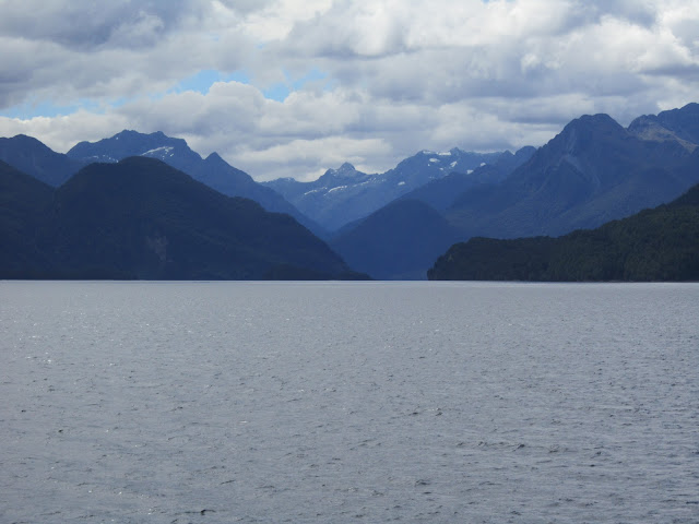
This was our first glimpse

Dana emerging from the clouds

We made it to MacKinnon Pass at the perfect time, as the sun was out and the clouds were beginning roll away. From what we hear, this is a rare event at the peak given that it rains 300 days a year and the peak is often under significant cloud cover. To say it was an incredible view is an understatement. The pictures help to tell the story, but check out the videos to get the 360 degree perspective.
McKinnon Pass is noted to have best toilet view in Fiordland. Think that might not be enough credit…..Anyone found a better toilet view in the world?
Videos:
View at the top. Note it is really windy! Yes, that is snow up there and it’s summer in NZ.
http://youtu.be/Ikap-n6E9-k
Reinaker went for a quick dip at the little pond at the top. Given that it was 40 degrees and windy, this was an insane idea (others laughing in the background felt the same). He dried off quickly, changed clothes and said he felt great afterwards. Gauging from his reaction…..the water was pretty cold. I certainly wasn’t tough enough to do the same.
http://youtu.be/FI6iAtKsV4I 
That wasn’t the end of the fun and adventure for day three. We headed down the mountain which is actually tougher on the legs than going up. We passed some beautiful sights on the way down. There is an optional 1.5 hour trip to Sutherland falls a few km before the hut. After hiking 6 hours, it was a tough decision to tack on an extra hike at this point. However we heard that it was the longest waterfall in New Zealand and you could walk behind it, so we left our packs on the trail and took the detour (much easier hiking without having to lug 30 lb packs with us!).
The waterfall was well worth the extra hike. The pictures can’t capture the true height, but it was intensely powerful. There was spray from the waterfall reaching a couple hundred feet away. Checking out the pool of water below the waterfall, it wasn’t really swim worthy as it couldn’t have been more than a foot deep. And this wasn’t a waterfall that you wanted to be directly under. I’m pretty sure that would kill a person. However Reinaker and I walked along the rocks and stood directly behind the waterfall. It was like being in a hurricane. Water was pelting you from all directions,with insanely loud and powerful winds and you could barely see with all the water coming at you. This description probably doesn’t sound appealing to most of you…..but it was awesome.At certain points there was so much water around that I would look in a certain direction and my vision had a circular rainbow. Not just a half circle rainbow, but a full 360 degrees rainbow wherever I looked. Maybe someone that knows science can explain that one.      
          
After our long adventure, we cooked up our last dinner on the trail. I was exhausted and declined any socializing, hitting the pillow sometime around 7 pm.

Sunday, March 25, 2012

Milford Track Day 1 & 2

The slogan for Milford Track is “the finest walk in the world”, which is no doubt high praise. The hike is all within Fiordland National Park in the southwest portion of the South Island. The full hike is 53.5 km (33.5 miles) over 4 days and ascends from sea level to 1,154 meters at the top of McKinnon Pass and then back down to sea level. After getting the bungy jumping out of our system, we hit the grocery store to fill up our packs with food and prepare for our journey.
 Just to get to the start of the track is a journey. We started early in the morning in Queenstown and took a bus ride to Te Anau, then jumped on another bus to catch a boat which dropped us off at the start of the track, deep into Fiordland. There isn’t much at the start, simply a dock for the boat to stop at and a sign signifying that this truly was the beginning of the Milford Track.

From the boat heading towards start of track

Drop off point, there is no going back from here

The first day’s walk is short, only taking around an hour and a half to reach the hut on the first night. There were two separate huts in different locations with undoubtedly different accommodations. We passed the glade hut which is where the guided walkers stayed. It reeked of luxury compared to the simple accommodations of the commoners hut that didn’t have guides. They had real beds, cooked meals, and hot showers. We had sleeping bags, ramen noodles and no showers. Plus the guided hikers were easy to pick out with their tiny backpacks and dorky name tags.

Dana in front of our first hut

The hiking portion of the first day is flat and for the most part we walked beside a river. As everyone is enthusiastic for the trip, we kept up a good tempo and made it to the hut a little quicker than anticipated. Once you’ve settled at the hut there really isn’t much to do. Your options are to cook and eat, or play cards. We played cards, cooked, ate, and then played some more cards.
There are rangers at each of the huts, and the ranger at the first one had an interactive night time tour showing us glowworms living underneath a rock. He also took us to the helicopter pad for a great view of the night sky. He pointed out the Southern Cross and other constellations, throwing around amazing stats about how far away certain stars and galaxies are. Don’t know if it was the wilderness setting or what, but I have never seen the night sky so clear.  
Day number two was a 16.5 km hike that started out flat and then started to climb elevation in the last few kilometres. The morning was a little cloudy, but the clouds moved out fairly quickly. The scenery was similar to what I saw in the Milford Sound with my parents, but instead of being in a boat, we were walking in a valley. There were some amazing views and plenty of waterfalls! We left my camera home and brought our small point and shoot, but still got some wonderful photos.

After the long hike, you are naturally starving, so you go through the same routine from the night before. At this point, you’re getting to know your fellow hikers pretty well. Almost all were foreigners and the ages ranged from the early 20s to 70. Germans, Australians, Israelis, Welsh, Dutch, Australians, and fellow Americans were represented (probably more nationalities as well….).

Sunday, March 18, 2012

New Zealand - Home of the Bungy Jump

Just a couple of days after the Hines' left, Matt Reinaker arrived to embark on a two week tour of New Zealand. Matt may guest author a post on VisitToTomorrow, so I won’t cover all of our adventures, but I'll touch on the highlights.
New Zealand is home to extreme sports. If you’ve got a desire to get your adrenaline pumping, you have plenty of options: skydiving, jet boating, zorbing (rolling down a hill in a massive plastic ball), sledging (whitewater rafting on a boogie board), and of course bungy jumping. Queenstown is the home of bungy jumping. We had the option of bungy jumping at the first commercial bungy bridge in the world (Kawarau Bridge – 43 meters), or the highest bungy jump in New Zealand (Nevis – 134 meters). We ended up choosing Kawarau Bridge as Nevis looked insanely intimidating, and you can’t go wrong with the bridge where people have been "safely" bungy jumping for 30 years. Dana decided that she was just going to watch from sturdy ground, having just seen this video of a bungy gone bad:


Kawarau Bridge

This picture might not give the height of the bridge complete justice. Standing beside it, it appears really high, and they either scare or inspire you with videos like this: http://www.youtube.com/watch?v=kGUPWbsjX1s as you walk into the building to book your jump. I’d be lying if I said I wasn’t scared. 
Here are pictures of Reinaker and I taking the jump, with some thoughts going through my mind at the time:
Your feet are tied together and they have you shuffle all the way out the edge and look at the camera man. Apparently I couldn’t even muster up a smile, as they had just told me I could be completely dunked in the river below.
Mr. Adrenaline Reinaker seems to be enjoying himself

The first part of the jump seems to be in slow motion, the guy gave me a slight nudge and it feels like you’re barely moving until your body in almost vertical.
Picture perfect form from Reinaker

Once your body goes vertical, it picks up acceleration so fast that once you realize you’ve jumped, you’re already at the bottom.

They told me to keep my arms out and head tucked in case I hit the water. I had the arms covered, but totally failed to keep my head tucked.

My hands hit the water, but I didn’t get fully dunked.

The rebound is fun, you’re relieved to know you have pretty much survived the jump.

You feel pretty helpless as they lower you into the boat. They bring you to the shore and then you feel like superman as the adrenaline is still flowing through your veins.
The 43 meters at Kawarau Bridge was enough for me for the first bungy. Reinaker was inspired by the jump and looked up the highest bungy jumps in the world. For those of you in the US…..the highest one in the world is 321 meters and is at the Royal Gorge Bridge in Colorado. Uhhh, that’s pretty high.   

Thursday, March 15, 2012

Kangaroo Island

After the Great Ocean Road, we were left with only two days remaining in the Hines family vacation. One was dedicated to exploring the culinary wonders of the Barossa Valley (north of Adelaide) and the other to catch wildlife and natural Australian landscapes at Kangaroo Island. 
Kangaroo Island sits off the southern coast of Adelaide and represents a piece of mostly unspoiled Australia nature. With a name like Kangaroo Island you might expect to see the marsupials dominating the island. They may do so, but only in the evening. Most of the wildlife in Australia comes out at night and is very quiet during the day. We arrived Kangaroo Island in the morning and drove the length of the island to some beautiful locations including Seal Bay and Flinders Chase National Park, but sadly the only kangaroos we saw were dead on the side of the road.

Seal Bay

Remarkable Rocks


Dana and Heather at Remarkable Rocks

Heather loves to be a model


New Zealand Fur Seals around Admirals Arch

Admirals Arch


On our drive back to catch the evening ferry, we finally caught a glimpse of the island’s namesake alive, hanging out in an open field. The wild ones aren’t all that excited to get close to humans, so they stayed at a distance. But even with distance between us, it was a magical sight.
After Kangaroo Island, it was a long trip back for the Hines family to the US: Adelaide to Sydney to Auckland to LA to Phoenix. I was very thankful they made the long journey to visit us on the other side of the world. After having a week in both New Zealand and Australia, they unanimously concluded they preferred New Zealand over Australia. Aussie has some impressive and lively cities in Sydney and Melbourne, but it’s tough to beat the beautiful landscape of New Zealand. And no, I’m not on the New Zealand tourism board payroll.

Sunday, March 11, 2012

The Great Ocean Road

Australia is a huge place. In New Zealand it is a short drive to most of the spectacular scenery. In Australia, the cities are many hours apart and the landscape is for the most part quite bland. So we jumped on a plane from Sydney to Melbourne to save ourselves 10 hours in the car.
Melbourne is another huge city with monster skyscrapers and plenty of people to fill the streets. Unfortunately we didn’t budget a whole lot of time to explore. We did however have a chance to stop in the open air Queen Victoria Market. Opened in 1878, it’s a massive market covering multiple city blocks with vendors selling produce, fresh meats, clothes, and just about anything else you’d want. Many of the foods have Greek origins as Melbourne has a large Greek population. We picked up some freshly baked bread, enjoyed some local musicians, then took off for our long ride along the Great Ocean Road to Adelaide.

Queen Victoria Market

The 12 hour drive from Melbourne to Adelaide is largely uninteresting; except for the 151 mile Great Ocean Road stretch that brings the highway right alongside the ocean. The highlight of the Great Ocean Road are the limestone cliffs and rock formations, slowly being eroded by the crashing surf.

Dad Leaves His Mark on The Great Ocean Road


The '12 Apostles' that are now down to 9


Part of the magic of Australia is seeing the native wildlife. 80% of the wildlife is nocturnal, so during the day the country doesn’t seem to have a heavy wildlife population. The Koalas are one of the exceptions, and can be found hanging out in the eucalyptus tree alongside roads. The Koalas are always conserving energy, so they will often times be sleeping or slowing grabbing a few more eucalyptus leaves to eat. They are either not afraid of humans, or they don’t want to expend the energy to climb away, so you can get pretty close to them.